INTRODUCTION
We have assumed that most of you will be using your own transport. If you are travelling by public transport (train or bus), however, we recommend that you use Nelson as your point of arrival. From the train/bus station, Shekinah is a 5-mile taxi journey.
Our postcode is BB12 9LP ….. but ,,,,, maybe it’s a bit unfair – although there is an element of truth – to say that Shekinah is not served very well by satnavs.
Use of BB12 9LP will get you within a mile or so of us, but we recommend that you use the instructions below as an aid to get you to the actual destination.
They are based on using St Anne’s Way in Fence as your initial destination. It’s easy to find and has a reliable postcode – BB12 9HL.
The directions from St Anne’s Way are immediately below.
We have provided, further down the page, details of how to get to St Anne’s Way if you like the old-fashioned method of road maps and written instructions. We hope that they will help.
FROM ST ANNE’S WAY TO SHEKINAH
After about 100 yards, take the second left (Noggarth Rd).
(From this point on, the roads are much narrower)
Drive up Noggarth Rd. After about a quarter of a mile, it bends sharply right and becomes even narrower. At this bend a signpost points you towards Newchurch and Barley.
After about 200 yards, just before entering the trees, turn left (brown pointer to Barley Picnic Site; direction pointers to Spenbrook and Newchurch).
Follow this road for about a mile to Spenbrook; it climbs for about half a mile, then wends down to the village.
Pass through the village, up the hill for 200 yards or so to the Newchurch village sign.
Within another 100 yards or so, as the road bends to the right, turn left on to Well Head Road. To achieve this very sharp left turn, you will need to swing over to the right-hand side of the road you have come up, and almost turn back on your direction.
Well Head Road is very much a single-lane road, so keep an eye open for possible passing places.
Shekinah is about half a mile along this road. You will be nearing it when you pass, on your left, a tiny hamlet of farmhouses. This is quickly followed by a sharp S-bend.
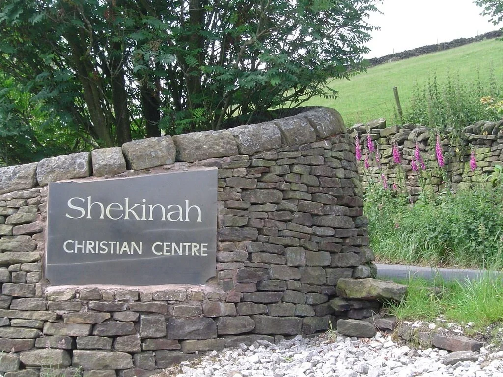
After the S-bend, the entrance to Shekinah is about 100 yards on your left.
Getting to St Anne’s Way ……
TRAVELLING FROM THE MANCHESTER/BURY DIRECTION VIA THE M66 AND A56
As you drop down the A56, you will eventually reach Junction 8 of the M65.
You have two choices, both equally easy:
From M65 Junction 8 via the A6068.
Keep in the left-hand lane, go under the motorway bridge, and continue straight ahead down the A6068. Use the instructions ‘From M65 Junction 8 via the A6068’ from this point.
From M65 Junction 8 via M65 Junction 13.
Keep in the right-hand lane, go under the motorway bridge, and turn right, on to the M65. Use the instructions ‘From M65 Junction 8 via M65 Junction 13’ from this point.
TRAVELLING FROM THE WEST (BLACKBURN, PRESTON, ETC) VIA THE M65
You have two options.
From Junction 8, turn left on to the A6068. Use the following instructions:
From M65 Junction 8 via the A6068
At Junction 13, turn left on to the A6068. Use the following instructions:
From the M65 Junction 13 via the A6068
FROM M65 JUNCTION 8 VIA THE A6068
At the bottom of the hill, continue straight ahead through the traffic lights uphill, still on the A6068. After about half a mile, continue straight ahead through the traffic lights, still on the A6068.
Continue along the A6068 for just short of three miles.
You will be given advance warning, via a road sign, of turning left to Fence, Spenbrook, and Newchurch, or turning right to Burnley (and Barden Mill)
About 25 yards after the turn-off (right) to Burnley, there is a signpost left to Fence, Spenbrook and Newchurch. Take that turn-off (on to St Anne’s Way)
Use the instructions in ‘From St Anne’s Way to Shekinah’
FROM M65 JUNCTION 8 VIA M65 JUNCTION 13
On the M65, travel towards Burnley and Nelson, and take the Junction 13 exit.
Keep in the left-hand lane on the slip road.
Turn left on to the A6068.
Use the following instructions:
From the M65 Junction 13 via the A6068
FROM THE M65 JUNCTION 13 VIA THE A6068
Apart from a small roundabout after about a quarter of a mile, you will find that the A6068 is a straightforward drive.
After about 2.5 miles, you will pass a road sign pointing left to Brierfield on the B6248.
Continue past that turning and take the next right after about 200 yards. (The road is signposted to Fence, Spenbrook and Newchurch, but the sign may be hard to spot behind the bushes).
The road is St Anne’s Way.
From other locations …..
TRAVELLING FROM THE EAST (COLNE, SKIPTON, ETC) VIA THE M65
Exit at Junction 13.
After leaving the slip road, keep in the right-hand lane of the roundabout until you approach the motorway bridge.
At that point, move into the left-hand lane, signposted to Fence on the A6068.
Go straight ahead on to the A6068 after the traffic lights.
Use the following instructions:
From the M65 Junction 13 via the A6068
FROM GISBURN VIA THE A682 THEN BARROWFORD
Drive through the village of Barrowford as far as the traffic lights just past Nelson and Colne College.
At the lights, use the right-hand lane.
Go straight ahead under the motorway bridge, keeping in the right-hand lane.
(After the motorway bridge is what seems to be a roundabout; there, however, is no access to it from your right-hand side)
Keep in the right-hand lane of the ‘roundabout’ until you approach the motorway bridge.
At that point, move into the left-hand lane, signposted to Fence on the A6068.
Go straight ahead on to the A6068 after the traffic lights.
Use the following instructions:
From the M65 Junction 13 via the A6068